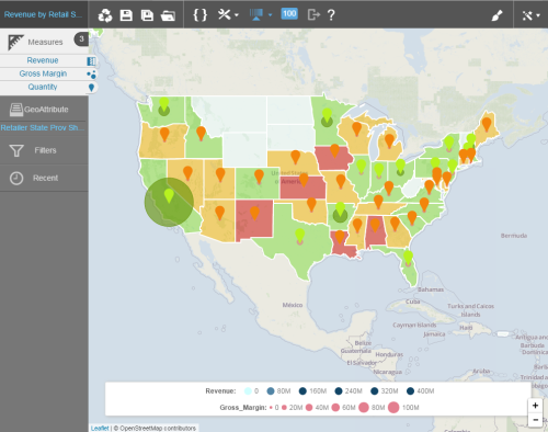
Use geomaps to display data by geographic region in a map format.
Topics on This Page
Create a Geomap
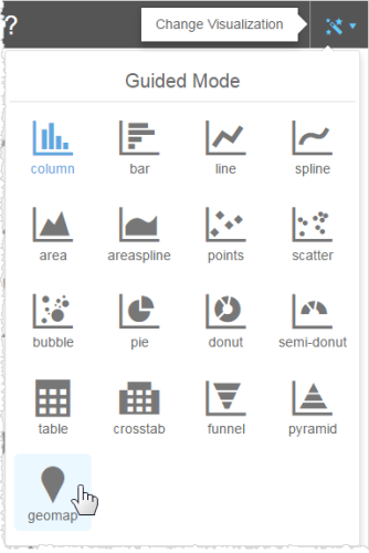
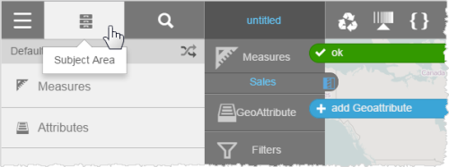
- In the Guided Mode menu, select geomap.The default map displays and Visualizer prompts you to add a measure and a geoattribute.
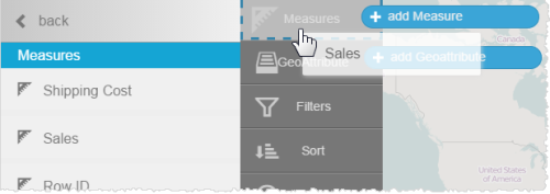
- Add a measure.
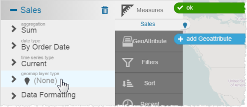
- Set the geomap layer type for the measure.
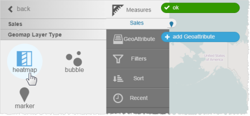
- Select a layer type.
- Click Subject Area. The measure in the Chart Builder shows the heatmap icon.
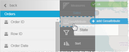
- Add a geoattribute.Visualizer prompts you to associate a map with the attribute.
- Click State.
- Click Maps, then select a map.
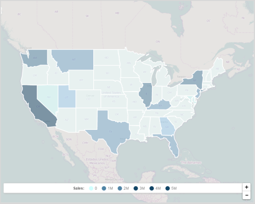
Visualizer applies the measure and the state attribute data to a heatmap.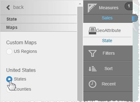
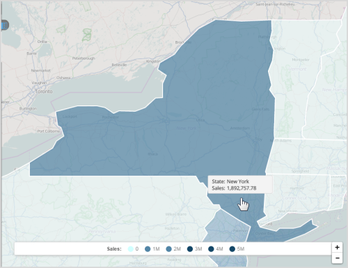
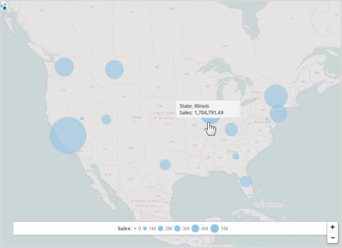
- Hover over the map to see the data. Click a state to zoom. Use the zoom controls to resize the heatmap.
Change the Layer Type
- Click a measure in the Chart Builder column.
- In the measure's properties, click Geomap Layer Type.
- Select another map style.
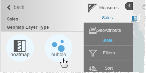
Visualizer applies the new layer type.
Change the Colors
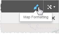
- Click Map Formatting.
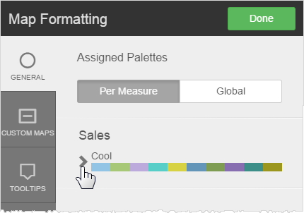
- In the pop-up, click the arrow next to the current palette.
- Select a different palette.
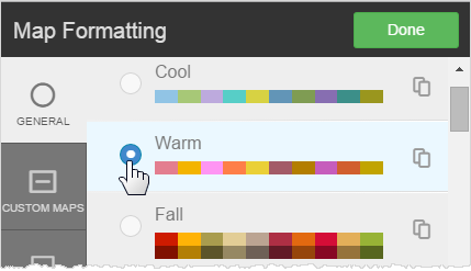 Tip: You can create and use a custom palette for your company.
 - Click Done.
Format Tooltips
Like other types of reports, you can apply tooltip formatting to geomaps.
- Click Map Formatting.
- Click Tooltips.
- Change any of the following, if needed:
- Text formatting
- Unit formats or percentage
- Suffix
- Decimal precision
- Currency symbol
- Click Done.
Save a Default Zoom Level
When you save a geomap, Visualizer retains its zoom level. You can set up a default map area based on a built-in map from which users can zoom in or out.
- Use the zoom control and move the map to the area you want to use as the default map.
- Save the geomap.
Overlay Measures With Layer Types
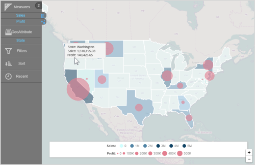
You can display one measure as a heatmap, another measure as a bubble map, and a third measure as a marker.
- Add a second measure to an existing map.
- Select the alternate chart type. Visualizer displays the two measures in two different chart layer styles.
Apply Conditional Formatting to Layers
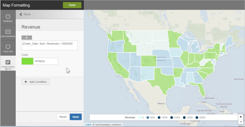
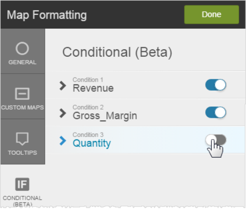
You can apply conditional formatting to geomaps using BQL![]() Business Query Language IF/ELSE syntax and color. This applies to any layer type.
Business Query Language IF/ELSE syntax and color. This applies to any layer type.
- Click Map Formatting.
- Click Conditional.
- Select the measure.
- Type the BQL expression for the condition. Tip: The BQL
 Business Query Language expression can be any expression that you want and it does not have to include the measure of the layer.
 - Select the color to apply when the condition is met.
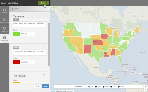
- Click Apply to preview the geomap conditional formatting.
- Optionally, add another condition.
- Click Done.
